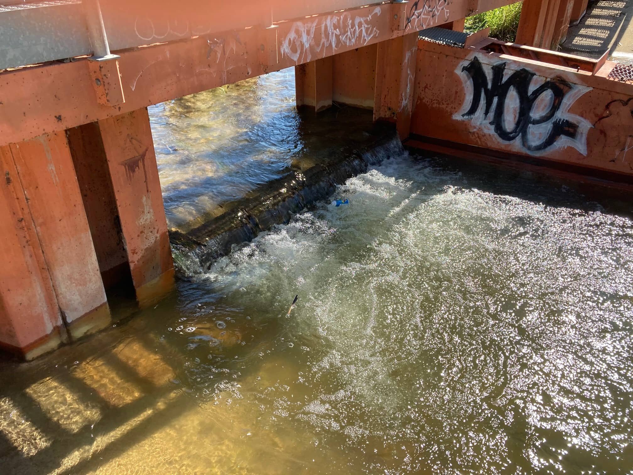
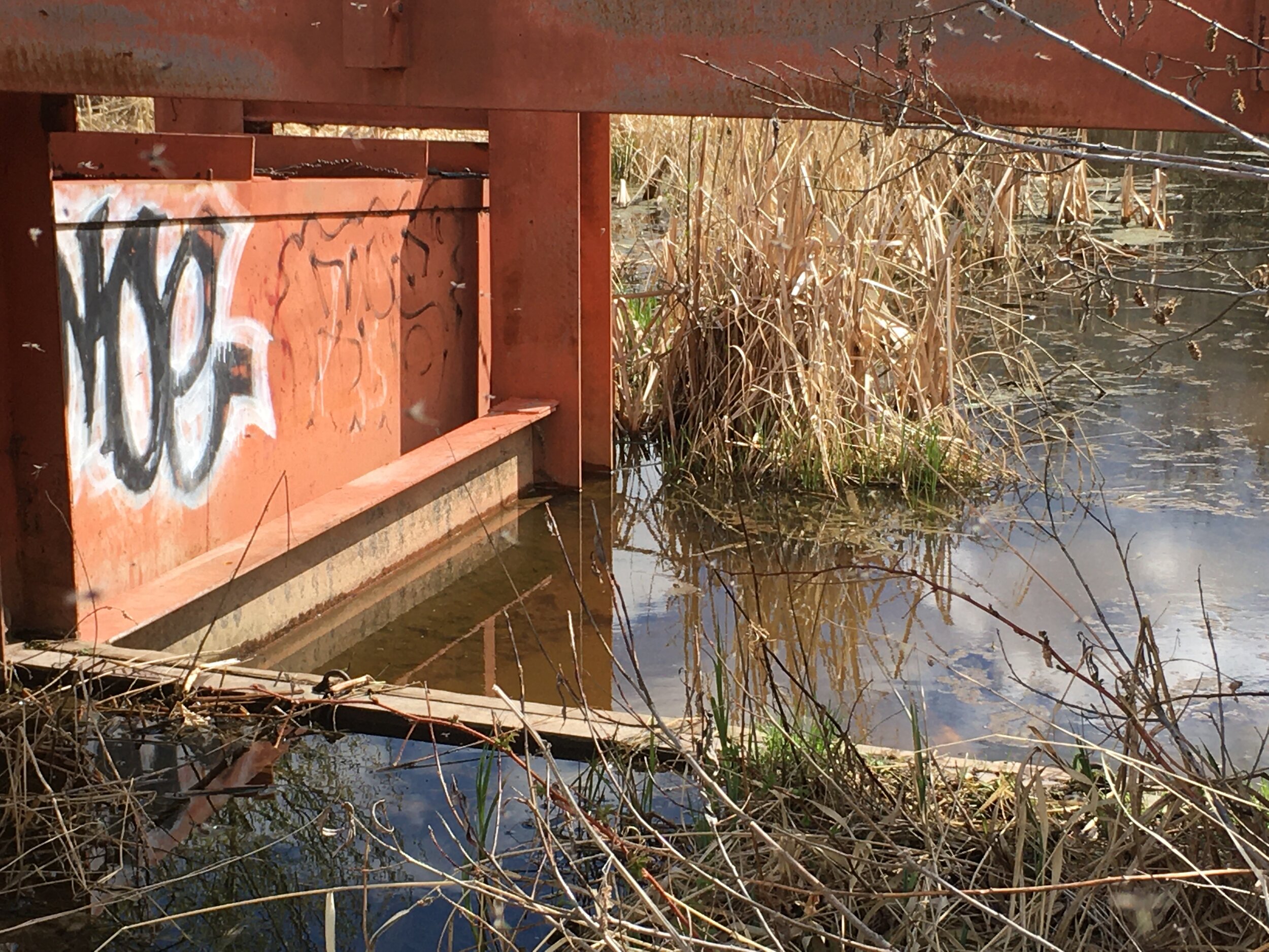
Weir

Weir after construction in 1986
History of the Weir
1914 Weir first built to control flooding of downstream hayfields during summer storms
1940 Weir rebuilt
1980 Spillway cleared of debris, resulting in flooding of the hay fields
1986 New structure added (including a fish ladder). Pigeon Lake Creek channel cleared to Battle River resulting in the draining of wetlands
1987 Weir Licensed by AEP Water Right #22106
1993 Current AEP operating procedures established with municipal agreement
The Pigeon Lake control structure (weir) is a water management facility located in the southeast corner of the lake near Ma-Me-O Beach on Pigeon Lake Creek which flows into the Battle River.
Pigeon Lake Weir
The weir was originally built in 1914 to control flooding of downstream hayfields (wetlands) due to summer storms. In 1986, after a period of high precipitation, the present structure was installed and the outlet channel reconstructed.
The structure is a two-bay structure with a fish ladder and operates with a weir elevation of 849.935 meters above sea level (MASL). The Pigeon Lake Creek channel was cleared of debris and straightened to improve the outlet conveyance capacity from the weir to within 4 km of the Battle River (South of SE18-45-27-W4).
Who owns and operates the weir?
Alberta Environment and Parks (AEP) owns and operates the weir. The Pigeon Lake weir is licensed under Water Right 22106 held by AEP. This license was issued February 2, 1987 and does not expire.
The Association of Pigeon Lake Municipalities, which include the twelve municipalities bordering Pigeon Lake, made recommendations in the 1990’s to AEP on the operation of the weir.
What is the purpose of the weir?
To control the rate of outflow from the lake during periods of high water in order to prevent flooding in the Pigeon Lake Creek channel. A natural sand bar develops across the mouth of the creek and high water levels can wash the sand bar away, thereby releasing large volumes of water from the lake into the creek. The uncontrolled flow of water from the lake has previously resulted in flooding of downstream locations, which was the original justification for the construction of the weir in 1914. The flow of water is attenuated by flowing over the weir in a controlled manner.
How is the weir operated?
The weir operating procedures were set by the province to balance several concerns. These include mitigating downstream flooding of agricultural lands, managing lake storage volume in the event of flooding, minimizing shoreline erosion, ice damage, protecting habitat for fish and wildlife and recreation.
Prior to 1992, the weir was operated with the weir elevation of 849.8 MASL. At a meeting on November 22, 1992, the Association of Pigeon Lake Municipalities recommended the weir operation change in 1993 by installing one stop log to raise the spill elevation to 849.935 MASL. The stop log would be removed when the water level reaches 850.09 MASL and reinstalled at a water level of 850.01 MASL. This would delay the flow of water from the lake during periods of high water but would also decrease the “surge capacity” of the lake in the event of storms.
Fluctuating Lake Levels and the Weir
The main factor affecting the water level is the amount and pattern of precipitation in the watershed:
Above Average Precipitation
For extended periods of above average precipitation, the lake level tends to rise above the weir and discharges into the creek. When the lake level reaches the predetermined elevation (850.09 MASL) the stop log is removed to help control high water levels. When the level reduces to the elevation of 850.01 MASL, the stop log is replaced. High lake levels present significant risk to the shoreline because of erosional forces of wave action in the summer and ice thrusts in the winter. See Pigeon Lake Water Level Fact Sheet
Average Precipitation
For years with average precipitation and lake levels, the weir is operated with one stop log in place. During spring runoff and higher precipitation may cause water to spill over the weir for a short period of time. However, later in the year higher evaporation and lower precipitation result in water levels dropping below the weir stop log.
Below Average Precipitation
During dryer climate cycles with below average precipitation, lake levels tend to remain below the weir with no outflow.
Lake Storage Capacity for Major Storms
Infrequently, a major storm will cause sudden and significant increases in water levels. For example, in 1990 a summer storm caused Pigeon Lake to rise 0.31 m from July 1st to 4th. The weir operating procedures are designed to maintain reserve storage to safely accommodate these storm events. The flood condition created by these events is accompanied by strong winds and waves which exacerbate shoreline erosion.
Frequently Asked Questions


PLWA Resources

Water Levels
References
Data used in the factsheet can be found in the Pigeon Lake Watershed Management Plan - Appendix C, Technical Summary.
Special thanks to Alberta Environment and Parks for assistance in developing this information sheet.